Today we’d like to introduce you to Brenton Roesner.
Hi Brenton, thanks for joining us today. We’d love for you to start by introducing yourself.
I’ve always been the person tinkering with electronics—first RC helicopters, then planes. When drones first emerged, I knew it wasn’t just a new gadget; it was the future, and I had to build a career around it.
Like many, I initially thought that meant aerial photography. But the real “aha” moment came when a friend asked me to join his survey company as their drone pilot.
That’s where I moved past just flying and learned the science.
I discovered the world of precision measurements, engineering, and survey-grade data. I realized the real value wasn’t in taking a pretty picture, but in capturing millions of high-accuracy data points that could inform massive engineering projects. I was completely hooked.
I founded SimpliFly with a clear mission: to bridge the gap. Many people can fly a drone, but few can deliver the meticulous, reliable data that engineering and survey firms actually need. We handle the complex science to give our clients simple, actionable results.
Fast forward six years, and that mission has taken us a long way. Our team has successfully mapped over 72,000 acres, with projects spanning 48 states and 5 countries.
Today, we’re still pushing the envelope. We’re proud to be collaborating with other industry leaders, like Wesley Pitts at TerraSync, and are currently working on a new research study with partners at UTK.
It started with tinkering in a garage, and now we’re helping to define the future of aerial data.
Alright, so let’s dig a little deeper into the story – has it been an easy path overall and if not, what were the challenges you’ve had to overcome?
Starting a service company in 2020 was a trial by fire. It was a time of massive global uncertainty, and we were trying to build new client relationships when face-to-face meetings were impossible and budgets were frozen. It forced us to be incredibly efficient and to prove our value from day one, which ended up being a core part of our identity.
But that challenge is small compared to the ones we face as an industry.
In the drone business, you don’t just have to adapt; you have to live in a state of constant adaptation. The technology, the software, and the regulations are in a constant state of flux.
The biggest challenge on our horizon right now is the looming regulatory uncertainty, specifically the potential ban on DJI equipment, which is the workhorse for most of the industry. This isn’t just an inconvenience; it’s a potential existential threat to thousands of small drone service providers.
It creates a difficult strategic problem:
On one hand, we have equipment that is proven, reliable, and delivers the precision data our clients require.
On the other, we face a future where that equipment might be outlawed, and the approved alternatives can cost 10-15 times as much, threatening to make services unaffordable for the very clients who need them.
This is the reality of our field. Our job isn’t just to be expert pilots or data scientists. Our true value to our clients is to be expert problem-solvers. We are the ones who navigate this technological and regulatory chaos—the new hardware, the complex software, the legal hurdles—so that our clients don’t have to.
Our clients just get the simple, reliable, and accurate data they need, period. That’s our promise. These struggles have only sharpened our focus on being the most resilient and adaptable partner we can be.
Great, so let’s talk business. Can you tell our readers more about what you do and what you think sets you apart from others?
We’re Not a Drone Company. We’re a Data Company.
At SimpliFly, our mission is right in our name. We take the complex, high-stakes work of aerial data acquisition and make it simple, reliable, and actionable for our clients.
There’s a fundamental misunderstanding in our industry. Many people think drone services are about taking pretty pictures. We know the truth: our clients aren’t paying for flight time—they’re paying for data integrity.
We are a scientific data company. The drone is just our tool.
What We Specialize In
We bridge the gap between flying a drone and delivering the survey-grade, high-precision measurements that engineering, construction, and survey firms can stake their reputations on.
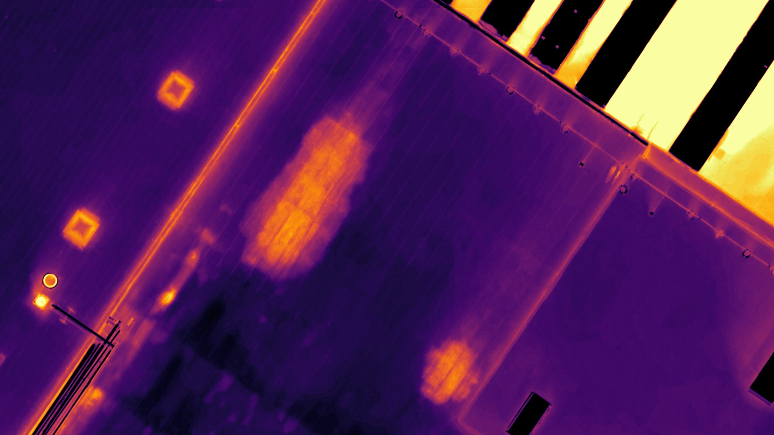
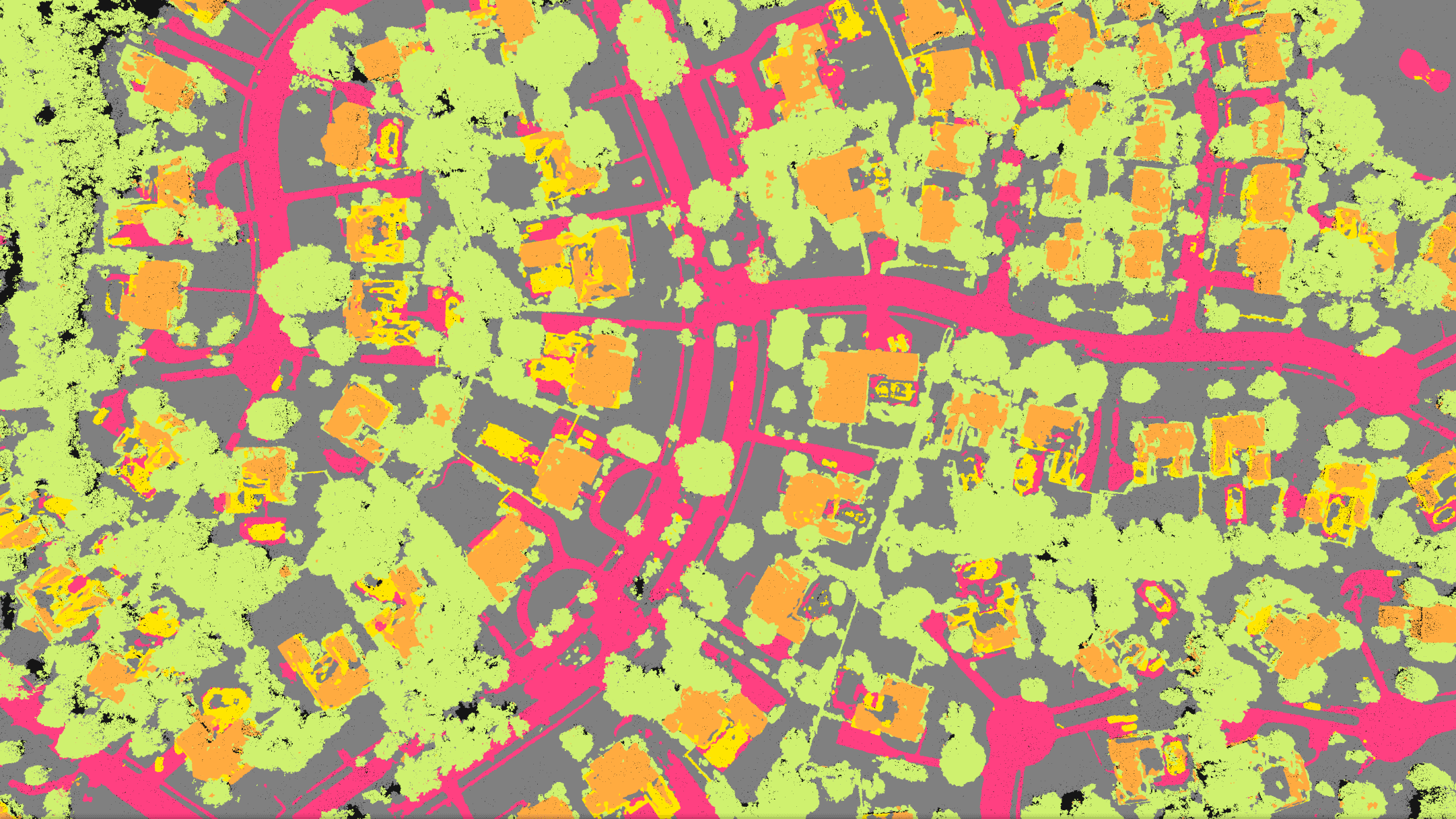
We deploy the right technology for the mission, from advanced photogrammetry (using high-resolution images) to high-density LiDAR (using laser scanning). Our core services include:
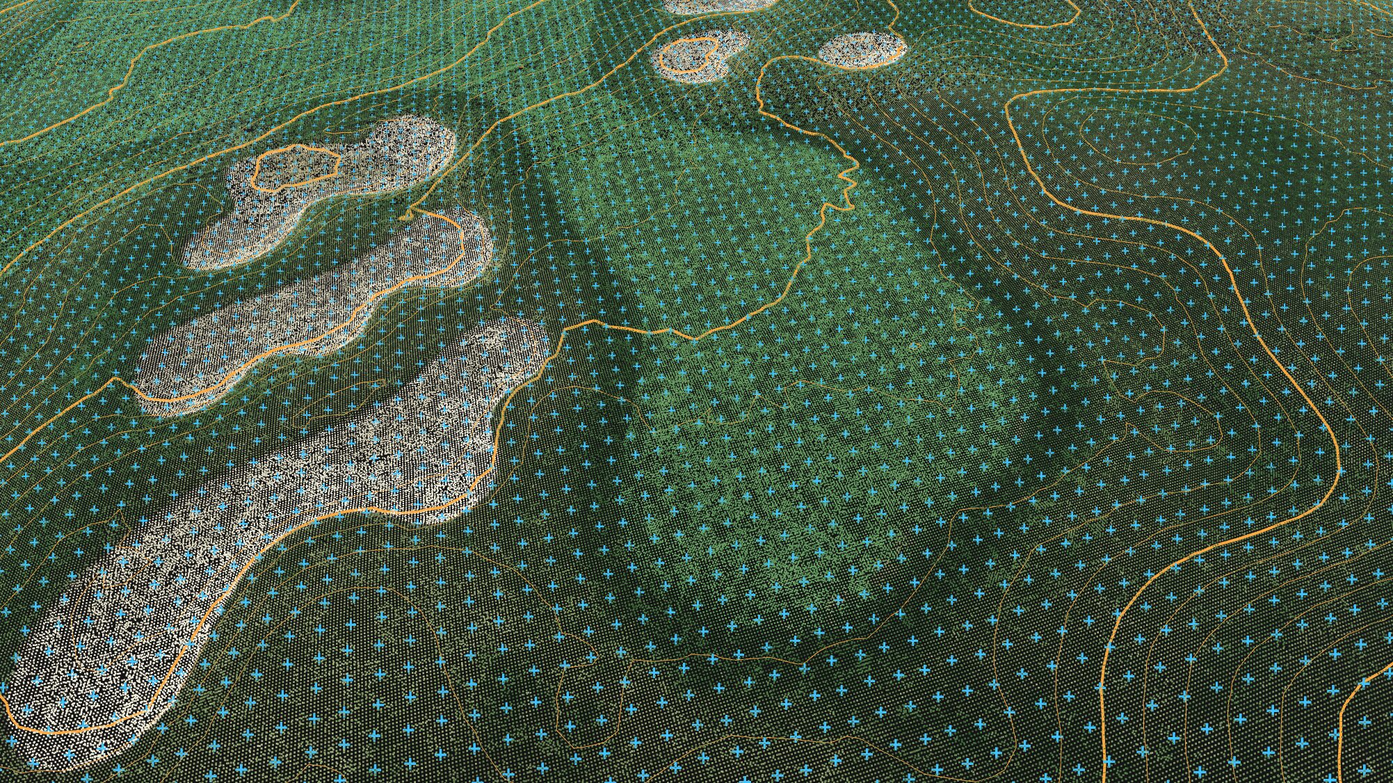
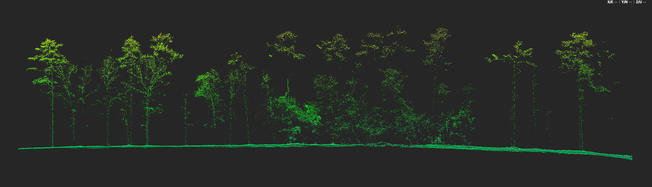
Survey-Grade Topographic Mapping & LiDAR: Creating high-resolution, georeferenced maps and 3D point clouds. LiDAR, in particular, allows us to map terrain with incredible accuracy, even through dense vegetation, providing a true ground surface model.
Engineering & As-Built Data: Capturing millions of data points for complex design, drainage analysis, and verifying existing conditions against design plans.
Stockpile Volumetrics: Delivering fast, accurate, and safe measurements of inventory for quarries, construction sites, and material suppliers, all without interrupting operations.
Construction Progress Monitoring: Tracking site changes with high-resolution 3D models and orthomosaics, allowing project managers to verify work and make critical decisions with confidence.
What Sets SimpliFly Apart
It comes down to two things: our experience and our mindset.
A Proven Track Record: In this business, experience is everything. In just six years, we have successfully mapped over 72,000 acres across 48 states and 5 countries. This isn’t a side hustle; it’s a portfolio of complex projects, delivered successfully under real-world conditions.
We Absorb the Complexity: The drone industry is in constant, chaotic flux. We face new hardware, new software, and massive regulatory hurdles. Our clients don’t have time to worry about any of that.
That’s our job.
We see it as our responsibility to navigate this chaos. We manage the compliance, master the technology, and solve the logistical problems. Our clients just get a stable, reliable partner who delivers the data they need, when they need it. No excuses.
What We’re Most Proud Of
Brand-wise, we’re most proud that our name—SimpliFly—is a promise we keep.
It’s not just a clever pun. It’s the feedback we get from our clients. We take an impossibly complex process (photogrammetry, LiDAR, georeferencing, regulatory compliance) and make the final handoff simple. Our clients get the exact data they need, in the format they expect, on time.
Where We’re Headed: The Future of On-Demand Data
If there’s one thing to know about us, it’s that we are always focused on the next horizon.
To that end, we are actively developing plans to launch the first publicly accessible autonomous “drone in a box” service right here in East Tennessee.
This isn’t just a new piece of tech. It represents a fundamental shift in how data is collected. It will allow our clients to access on-demand, repeatable aerial data for site monitoring, security, or stockpile measurements—autonomously, safely, and without a pilot even needing to be on-site.
It’s the next logical step in making complex data acquisition truly simple and reliable, and we are proud to be building that future right here.
We love surprises, fun facts and unexpected stories. Is there something you can share that might surprise us?
Something surprising many people might not know about me, is I love plane spotting. Trying to capture great photos, and locate which flight path is right in front of me, is a great pastime to get wrapped up in while going about day to day life.
Contact Info:
- Website: https://www.simplifly.us
- LinkedIn: https://www.linkedin.com/in/brenton-roesner